Lisbon, Portugal · open to work remotly or relocate to any place in Europe

Beatriz Peres

Geospatial engineer & Earth Observation

I work with remote sensing and deep learning , with geospatial foundation models and satellite image time series, asking whether embeddings learned in one place and one season still transfer to other domains.

Before research came two years of commercial LiDAR, photogrammetry and survey engineering, and before that a degree in art conservation.

  • 3 disciplines learned from scratch — fine arts, geomatics, AI for EO
  • 4 countries of study — Portugal, Italy, Austria, France
  • 2 years Working and studying remote sensing with AI applications
  • 2 years commercial survey delivery, acquisition to signed-off product

01 — About

An unusually wide profile, on purpose

My current focus is geospatial foundation models, machine learning and deep learning applied to Earth observation, with satellite image time series — SAR, optical and multispectral — as the central object of study. The guiding question studied on my master thesis is how learned embeddings transfer across regions, seasons and sensing conditions.

That research sits on top of a genuinely different first career. Years spent producing survey deliverables that had to be checked, defended and signed off built the habit of asking what a dataset's error budget actually is, where the uncertainty comes from, and whether a number can be trusted. Classical geomatics is not a detour from the present work — it is the foundation for it, and it shapes how I read machine learning results: with attention to what the data physically is, how it was acquired, and what a headline accuracy figure conceals.

Before geomatics there was a third field entirely: art history, conservation and restoration of fine arts, including an Erasmus exchange in Rome. That training taught close observation, material analysis, documentation discipline and the patience of slow, reversible work on objects that cannot be replaced. It also produced someone comfortable being a beginner in a new discipline — which turned out to be the transferable skill that mattered most.

The result: I have surveyed in the field, flown drones, processed point clouds under commercial deadlines, and then trained transformers on Sentinel time series and interrogated their embeddings for hidden geographic bias. I can speak credibly to engineers, remote sensing scientists and machine learning researchers, because the work has genuinely been done in all three registers.

  • Three complete retrainings

    Fine arts and conservation, then geospatial engineering, then AI for Earth observation — each a full change of vocabulary, method and community, carried through to a degree or a working role.

  • Whole-stack on a geospatial problem

    Field acquisition and drone piloting, proprietary survey software, scientific Python, deep learning, cloud-native formats, distributed compute — end to end rather than one layer of it.

  • Bilingual between industry and research

    Commercial survey rewards throughput, tolerances and deliverables that pass inspection. Research rewards ablations, baselines and claims that survive scrutiny. I have worked under both.

  • Fast in unfamiliar environments

    Spark, Zarr, PyTorch and RIEGL's proprietary chain share almost nothing with each other, and were picked up across three institutions, one company and one engineering internship in a few years.

  • Comfortable outside the technical silo

    A cross-disciplinary programme in Romania put geomorphologists, engineers, climate scientists, psychologists, sociologists and anthropologists around one problem, with a joint output required.
Areas of expertise

Geospatial foundation models & representation learning

Frozen embeddings, lightweight classifiers on top of them, and — more distinctively — probing what those representations actually encode: domain shift quantification, adversarial adaptation, label-efficiency ablations.

Satellite image time series

Building, harmonising and modelling multi-date Sentinel-1 and Sentinel-2 series with irregular acquisition, applied to crop-type classification and agricultural monitoring.

Deep learning & computer vision for EO

Vision transformers, U-Net and CNNs; semantic segmentation, object detection, classification of imagery and point clouds — with train/test protocols that respect spatial and temporal autocorrelation.

Multi-modal remote sensing

SAR (including interferometry), optical and multispectral, hyperspectral, VHR imagery and LiDAR — and what each modality can and cannot physically resolve.

Classical geomatics & survey engineering

Aerial LiDAR, mobile mapping, terrestrial laser scanning, UAV photogrammetry, terrain modelling, structure monitoring, volumetrics, GNSS, total station and bathymetry — performed commercially, to client tolerance.

Quality control & statistical validation

A deliberate specialism, not an incidental duty: fair baselines, evaluation splits that do not leak, retained accuracy rather than headline numbers, and unexplained improvements treated as bugs until proven otherwise.

Cloud-native geospatial data & scale

COG, Zarr, STAC catalogues and EO data cubes; Spark and Dask for distributed computation; Parquet for large point-cloud and imagery workloads — including contributing to the modernisation of Copernicus Sentinel data formats.

Natural hazards, vulnerability & risk

Hazard dynamics in fragile landscapes, multi-hazard cascades, exposure and social vulnerability, and impact chain modelling — the step that connects an EO measurement to why it is being made.

02 — Current research

Do foundation model embeddings carry geography with them?

MSc thesis · 03/2026 – 09/2026 IRISA — Obelix team, Vannes Université Bretagne Sud + PLUS Salzburg

Spatial and Temporal Transferability of Geospatial Foundation Models — A Case Study on Crop-Type Identification from Satellite Image Time Series

Supervisors: Charlotte Pelletier and Karima Hadj-Rabah.

Geospatial foundation models are promoted as a way to cut the annotation cost of crop-type mapping, on the assumption that their embeddings capture crop information that stays useful across regions and growing seasons. This thesis takes that assumption seriously enough to test it — asking whether the representations actually separate crop identity from the geographic and environmental context in which the observations were made, or whether the two stay entangled so that a model trained in one country quietly inherits that country's conditions.

66%

Cross-country transfer retained by the embeddings, against 59% for the raw Sentinel time series.

92–94%

Cross-year transfer retained, against 88% for the raw baseline.

¼

of the labels needed for embedding models to match or beat the raw-data baselines.

+2.8pp

from domain-adversarial adaptation — real, but most of the transfer loss remained.

The finding: TESSERA embeddings transfer well across growing seasons but less effectively across countries. Pre-training reduces spatial domain shift without removing it — crop information stays entangled with geographic and environmental factors.

Read the full abstract
Geospatial foundation models are proposed as a way to reduce the annotation burden of crop-type mapping, assuming that their embeddings capture crop information that remains useful across regions and growing seasons. However, it is still unclear whether these representations separate crop identity from the geographic and environmental context in which they were observed. This thesis evaluates this assumption using TESSERA embeddings, a time series geospatial foundation model, and 13 harmonised EuroCrops classes across 10 European countries for 2018 and across Austria for 2016–2023. Lightweight classifiers were trained on one country or year and evaluated on others, using the raw Sentinel-1 and Sentinel-2 time series as a baseline. Probing experiments tested whether country, coordinates, and acquisition year could be recovered from the embeddings, while domain-adversarial adaptation was used to reduce the recoverable domain information. Cross-country transfer retained 66% of in-distribution accuracy for the embeddings, compared with 59% for the raw series, while cross-year transfer retained 92–94%, compared with 88%. Embedding-based models also matched or exceeded the raw-data baselines using only one quarter of the labels. Adversarial adaptation improved mean target accuracy by 2.8 percentage points, but most of the transfer loss remained. These results show that TESSERA embeddings transfer well across growing seasons but less effectively across countries. Pre-training reduces spatial domain shift but does not remove it, indicating that crop information remains entangled with geographic and environmental factors.

03 — Experience

From field survey to research code

  1. 03/2026 – 09/2026 Vannes, France · 7 months

    Researcher (MSc thesis) — IRISA Lab, Obelix team

    Research position inside the Obelix team at IRISA (UMR CNRS 6074), a remote sensing and machine learning group whose work centres on satellite image time series, domain adaptation and land cover mapping — the exact intersection the thesis occupies.

    Carried out as work in an active laboratory rather than an isolated student project: a full experimental programme on the transferability of geospatial foundation model embeddings, designed, implemented and evaluated over seven months with regular supervision from a specialist in satellite image time series classification and domain adaptation.

    • PyTorch
    • TESSERA
    • EuroCrops
    • Sentinel-1/2
    • scikit-learn
    • Domain adaptation

    See the research in detail

  2. 07/2025 – 09/2025 Lisbon, Portugal · international team · 2 months

    Intern — Development Seed

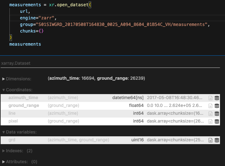
    An engineering internship in cloud-native Earth observation data infrastructure, working alongside an international open-source team. The work centred on data formats for large EO archives: Cloud-Optimized GeoTIFF and, principally, Zarr — exploring what the new Zarr specification changes about storing and serving satellite data at scale.

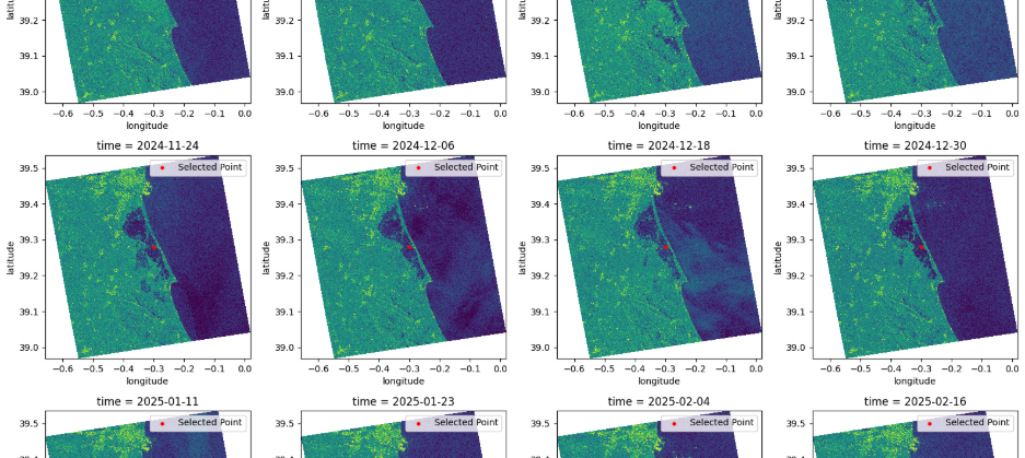
    This fed into a contribution to ESA's EOPF Toolkit, whose purpose is to modernise and harmonise the data products of the Copernicus Sentinel missions, and closed with a study on flood mapping in Valencia.

    Opening a Sentinel-1 GRD measurement group directly from a Zarr store with xarray
    Sentinel-1 GRD opened straight from a Zarr store with xarray.
    Grid of Sentinel-1 backscatter images over Valencia across successive dates
    Sentinel-1 backscatter time series over Valencia during the flood.
    The Development Seed team sitting together at an outdoor table in Lisbon
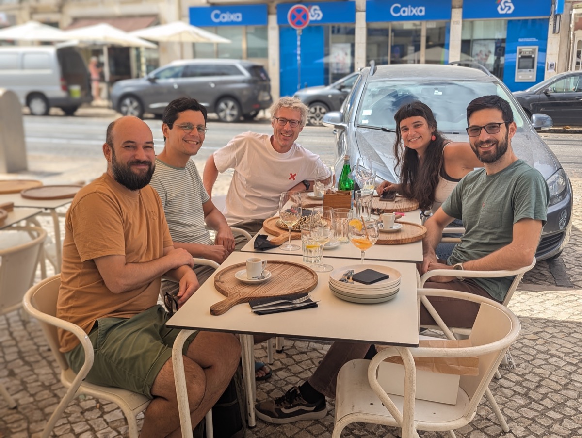
    With part of the Development Seed team, Lisbon.
    • Zarr
    • COG
    • xarray
    • STAC
    • Dask
    • Open source
  3. 09/2022 – 07/2024 Barreiro, Portugal · ~2 years

    Geospatial Engineer — Geotrilho

    A full commercial survey engineering role covering acquisition through to delivered product.

    • Acquisition: aerial LiDAR, mobile mapping and terrestrial laser scanning, and UAV-based photogrammetry — including piloting the aircraft for survey missions.
    • Processing & products: Digital Terrain Model creation and modelling, feature extraction, structure monitoring for deformation and change, and stockpile volume measurement.
    • Running through all of it: inspection and quality control of geodata — verifying that deliverables met specification and tolerance before they left the company. This is where the interest in statistical validation became a specialism rather than a routine.
    • Cyclone3DR
    • RiACQUIRE / RiPROCESS
    • POSPac MMS
    • Agisoft Metashape
    • TopoDOT
    • QGIS
  4. 04/2022 – 08/2022 Barreiro, Portugal · 5 months

    Geospatial Engineering Intern — Geotrilho

    Introduction to professional topographic survey: the fundamentals of the survey process, extracting the required features from acquired data, and the comparative characteristics, use cases and limitations of the three principal acquisition families — terrestrial (TLS), mobile (MLS) and airborne (ALS) laser scanning. The internship converted directly into the engineer role.

  5. 10/2020 – 03/2022 Lisbon, Portugal

    Barista — Copenhagen Coffee Lab

    Held alongside full-time study for the Geospatial Engineering degree — the degree was self-supported.

04 — Projects

Selected work

Research, engineering and coursework projects. Filter by the kind of work you are looking for.

MSc thesis · Université Bretagne Sud

GFM embedding transferability for crop-type mapping

A full experimental programme testing whether TESSERA embeddings separate crop identity from geography — across ten European countries and eight Austrian years, with raw-time-series baselines, probing, domain-adversarial adaptation and label-budget ablations.

  • PyTorch
  • TESSERA
  • EuroCrops
  • Sentinel-1/2
  • scikit-learn
Full write-up

Development Seed · ESA EOPF Toolkit

Cloud-native Sentinel data in Zarr

Work on cloud-native storage of Copernicus Sentinel data, exploring the new Zarr specification's potential against established COG-based access patterns, in service of modernising and harmonising Sentinel data products.

  • Zarr
  • COG
  • xarray
  • STAC

Development Seed

Flood mapping in Valencia

Closing study of the internship: mapping the Valencia floods from a Sentinel-1 backscatter time series served directly out of cloud-native storage, rather than downloaded scene by scene.

  • Sentinel-1 SAR
  • xarray
  • Zarr
  • matplotlib

Université Bretagne Sud

Distributed BigEarthNet classification

Classifying the BigEarthNet Sentinel-2 benchmark at scale with a parallel big-data approach, rather than on a single machine.

  • Spark
  • PyTorch

Université Bretagne Sud

Distributed point cloud classification

Parallel classification of point-cloud datasets too large for single-machine processing, stored columnar in Parquet and processed with Spark — combining point-cloud domain knowledge from industry with distributed computing.

  • Spark
  • Parquet
  • Python

Université Bretagne Sud

Swimming pool segmentation

A semantic segmentation pipeline detecting swimming pools from aerial and satellite imagery — a small-object, high-imbalance segmentation problem.

  • PyTorch
  • U-Net
  • OpenCV

Université Bretagne Sud

Drought prediction from time series

Machine learning applied to environmental time series to anticipate drought conditions, involving feature construction from temporal signals and model selection.

  • pandas
  • scikit-learn

PLUS Salzburg

SNAP processing chain as a Python API

A tool reproducing the processing steps and operators of ESA SNAP programmatically — converting an interactive, click-driven desktop workflow into scripted, reproducible, repeatable code.

  • Python
  • ESA SNAP

PLUS Salzburg · Advanced Remote Sensing

SAR interferometry

SAR processing through to interferogram generation, covering the coregistration and phase handling the technique requires.

  • SNAP
  • Python
  • InSAR
Report (PDF)

PLUS Salzburg

LiDAR point cloud classification

Semantic classification of LiDAR point clouds in Python notebooks — applying machine learning to data of the same kind previously handled commercially with proprietary survey software.

  • Python
  • Open3D

PLUS Salzburg · Advanced Remote Sensing

Satellite image classification & segmentation

Supervised classification and segmentation of EO imagery, including class design, training and accuracy assessment.

  • Python
  • scikit-learn
Report (PDF)

PLUS Salzburg · Digital Earth

Burn severity after the Pedrógão Grande fires

A Big Earth Data study of burn severity following the 2017 Pedrógão Grande wildfires in Portugal, built on EO data cube concepts rather than single scenes.

  • EO data cubes
  • Python
  • Sentinel-2

PLUS Salzburg · Spatial Simulations

Simulating grazing dynamics on Vierkaser pasture

Systems thinking in spatial representations: simulating spatial and temporal dynamics of grazing to study how a complex system responds before the ecosystem is disrupted.

  • Agent-based simulation
  • Spatio-temporal modelling
Report (PDF)

PLUS Salzburg · Methods in Spatial Analysis

Visibility and terrain analysis

Terrain-based spatial analysis — viewshed and visibility modelling over digital elevation data, and the methodological choices that determine whether the result means anything.

  • GIS
  • DEM analysis
  • QGIS

PLUS Salzburg · Spatial Databases

Relational & spatial data management

Designing and querying spatial databases: schema design, spatial indexing and SQL over geometry, as the storage layer beneath geospatial analysis.

  • SQL
  • PostGIS

BIP · University of Bucharest

Impact chain model for seismic risk, Valea Lupului

A team-built causal model linking an earthquake hazard in a Romanian village to exposure, structural and social vulnerability, and downstream impacts — developed from field observation and presented to programme lecturers.

  • Impact chain methodology
  • Multi-hazard risk assessment

05 — Community & field

Beyond my own project

08–10 April 2026 Université Bretagne Sud, Campus Tohannic, Vannes

Organising team — AI4EO Spring School 2026

An international three-day school on artificial intelligence for Earth observation, co-organised by the Obelix team at IRISA with the Erasmus Mundus Copernicus Master in Digital Earth, the SequoIA cluster (PANORAMIX chair) and ESA Φ-lab, supported by Université Bretagne Sud and the European Space Agency. It followed the AI4EO 2025 symposium held in Rennes the previous autumn.

The programme covered foundation models for Earth observation, MLOps, responsible AI and generative models, delivered as lectures by invited scientists alongside hands-on coding workshops and a collaborative data-driven project run with ESA Φ-lab. Attendance was free but competitive, with applications reviewed and places capped; participants could obtain 3 ECTS.

Invited speakers included Pedram Ghamisi and Weikang Yu (HZDR), Adam Stewart (TUM), Stéphane May (CNES), Iris de Gélis (Observatoire de Paris, PSL), Nicolas Audebert (IGN) and Pierre Adorni (IRISA).

Contributing to an event of this kind — international speakers, several partner institutions including a space agency, a selected cohort of postgraduate participants — means working on the delivery side of scientific exchange rather than only the receiving side.

03/2025 – 04/2025 University of Bucharest, Romania Certificate awarded

Blended Intensive Programme — Quantifying Vulnerability to Natural Hazards in Changing Climate Patterns

Five weeks of virtual sessions followed by five days of fieldwork. The virtual component was deliberately cross-disciplinary, with lecturers from climate science, geomorphology, engineering, psychology, sociology and anthropology — covering vulnerability in the Anthropocene, geohazard dynamics in fragile landscapes, sea level change and adaptation, landscape and community resilience, and social vulnerability in coastal environments.

The field component ran in Bucharest and the Vrancea seismic region: a walking survey of structural retrofitting on buildings still carrying the vulnerability exposed by the 1977 earthquake, then a shallow landslide in Subcarpathian molasse, a reservoir site where construction induced slope instability, an earthquake-triggered landslide as a hazard cascade, terrain reshaped by mudflows, a village surveyed on foot to compare structural vulnerability across housing types, and active mud volcanoes — which framed the problem of disaster risk reduction inside protected areas.

The assessed output was an impact chain model, built in a small mixed team: a structured causal representation of an earthquake scenario in Valea Lupului, tracing the hazard through exposure, physical and social vulnerability, to the resulting impacts. That is the analytical step remote sensing work often stops short of.

The Blended Intensive Programme cohort standing on a hillside in the Vrancea region, Romania
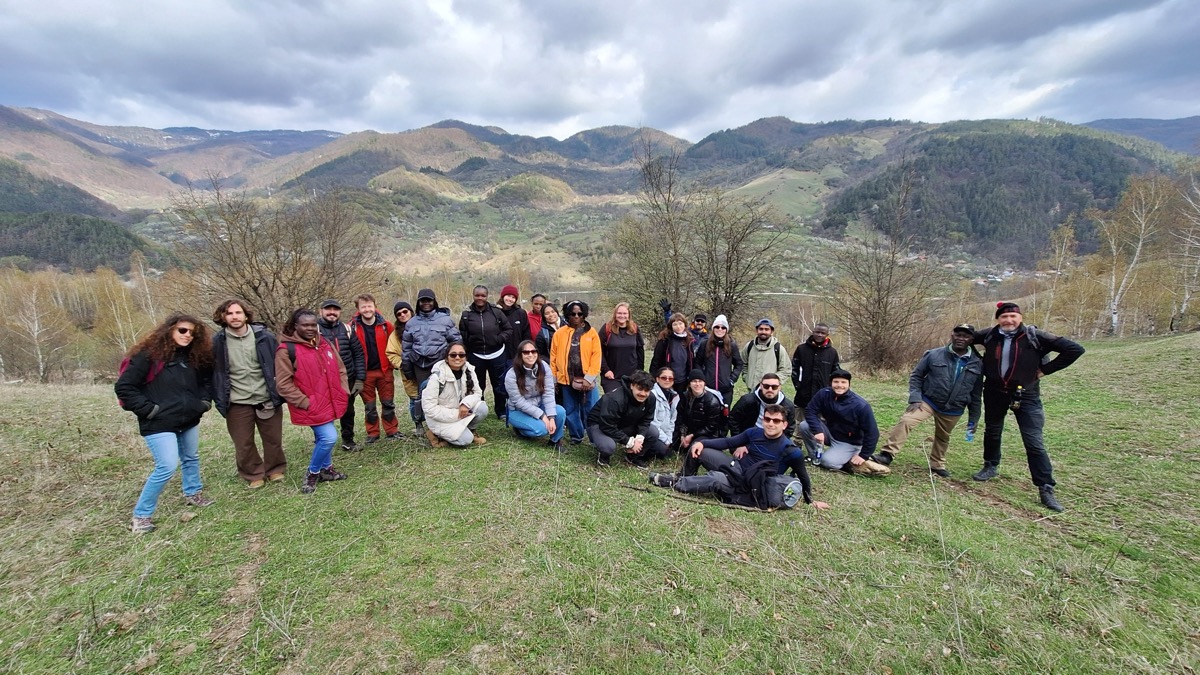
Fieldwork with the cohort in the Vrancea seismic region.

06 — Skills

Technical toolkit

Accumulated across three institutions, one survey company and one engineering internship — several of these ecosystems share almost nothing with each other.

Programming

  • Python
  • Bash
  • SQL
  • Spatial SQL
  • HTML & CSS

Deep learning & ML

  • PyTorch
  • TorchGeo
  • Keras
  • TensorFlow
  • scikit-learn
  • umap-learn

Methods: vision transformers · U-Net · CNNs · foundation models and frozen-embedding workflows · semantic segmentation · object detection · time series classification · domain adaptation and adversarial training · dimensionality reduction · probing

Geospatial Python

  • rasterio
  • rioxarray
  • xarray
  • geopandas
  • shapely
  • fiona
  • pyproj
  • affine
  • pystac
  • planetary-computer
  • stackstac
  • earthengine-api
  • geotessera
  • OpenCV
  • Open3D

Data engineering & scale

  • NumPy
  • pandas
  • SciPy
  • PyArrow / Parquet
  • Dask
  • joblib
  • Apache Spark
  • HDF5
  • Zarr
  • COG
  • STAC
  • EO data cubes

Visualisation

  • matplotlib
  • seaborn
  • plotly
  • bokeh

Tooling & workflow

  • Git & GitHub
  • Docker
  • uv
  • Hugging Face
  • Jupyter
  • requests

Survey & geomatics software

  • Cyclone3DR
  • POSPac MMS
  • RiACQUIRE
  • RiPROCESS
  • Agisoft Metashape
  • TopoDOT
  • ESA SNAP
  • QGIS
  • ArcGIS

Sensors & data types

  • Sentinel-1 SAR
  • Sentinel-2 multispectral
  • Hyperspectral
  • VHR optical
  • Airborne LiDAR
  • Mobile LiDAR
  • Terrestrial LiDAR
  • UAV imagery
  • GNSS
  • Bathymetry
  • Total station

Applied risk methods

  • Impact chain modelling
  • Hazard, exposure & vulnerability assessment
  • Multi-hazard cascade analysis

Languages

Language Listening Reading Writing Speaking
Portuguese Native Native Native Native
English C2 C2 C1 C1
French B2 B2 A2 B2
Italian B1 B1 A1 A2
Spanish B1 B1 A1 A1

Study and work conducted in Portuguese, English and partly in Italian during the Rome exchange, with two academic years spent in French- and German-speaking countries.

07 — Education

Four degrees of separation, closed

  1. 09/2024 – 10/2026 Austria → France

    MSc — Copernicus Master in Digital Earth

    Erasmus Mundus Joint Master Degree · full scholarship holder

    A two-year European joint programme delivered across two universities, competitively selected and funded by an Erasmus Mundus scholarship, combining Earth observation science with data science and requiring relocation between countries between the two years.

    Year 1 — Paris Lodron University of Salzburg (PLUS), Austria · Remote sensing

    Remote sensing across the full range of modalities — hyperspectral, SAR, optical, multispectral, VHR and LiDAR — alongside EO data cubes, the structure and mission architecture of Copernicus and the Sentinel constellation, big data concepts, spatial databases and scientific programming for EO workflows.

    Courses: Advanced Remote Sensing · Methods in Spatial Analysis · Systems Thinking in Spatial Representations · Spatial Databases · Digital Earth: Big Earth Data Concepts

    Practical work: supervised classification and segmentation of satellite imagery · LiDAR point cloud classification in Python · SAR processing through to interferogram generation · and, most substantially, a Python API reproducing the processing steps and operators of ESA's SNAP toolbox programmatically.

    Year 2 — Université Bretagne Sud (UBS), Vannes, France · Geodata Science

    A machine learning and data engineering specialisation applied to geospatial problems: machine learning, deep learning and computer vision; foundation models and large geospatial AI models; foundations of remote sensing analysis; efficient remote sensing image processing; big data and parallel computing; cloud-based computing.

    Project work: drought prediction from environmental time series · parallel classification of large point clouds in Parquet with Spark · distributed BigEarthNet classification · semantic segmentation for swimming pool detection.

  2. 09/2019 – 06/2022 Lisbon, Portugal

    BSc — Geospatial Engineering

    Faculdade de Ciências, Universidade de Lisboa

    A full engineering degree covering remote sensing, geomatics, programming, satellite systems, GNSS and navigation, GIS and mapping. The practical training spanned both ends of the methodological range: classical instrument survey with total stations and levelling, and modern acquisition including bathymetric survey and UAV-based mapping. Completed while working part-time.

  3. 09/2018 – 03/2019 Rome, Italy

    Erasmus exchange — Conservation and Restoration of Cultural Property

    Accademia di Belle Arti di Roma

    A semester specialising in conservation and restoration of cultural property, in Italian, within a different pedagogical tradition.

  4. 09/2016 – 06/2019 Lisbon, Portugal

    BSc — Art and Heritage Sciences

    Faculdade de Belas Artes, Universidade de Lisboa

    Art history, and the theory and practice of conservation and restoration of fine arts. Training in close visual analysis, material and condition assessment, documentation, and intervention ethics.

Certifications, service & distinctions

  • Erasmus Mundus scholarship

    Copernicus Master in Digital Earth — competitive European funding awarded to selected candidates for a two-university joint master.

  • Organising team, AI4EO Spring School 2026

    International spring school on AI for Earth observation, Vannes, April 2026 — IRISA/Obelix, Copernicus Master in Digital Earth, Cluster SequoIA and ESA Φ-lab.

  • EASA A1–A3 Open Subcategory remote pilot certificate

    European drone licence, held and used professionally for UAV survey missions.

    View certificate
  • Blended Intensive Programme certificate

    Quantifying Vulnerability to Natural Hazards in Changing Climate Patterns — University of Bucharest, 2025.

  • Proof of English proficiency

    C2 listening and reading, C1 writing and speaking.

    View certificate
  • EU Space Academy — Business Badge

    European space sector training badge.

    View badge
  • VHF Global Safety Passport

    Site safety certification for industrial and survey environments.

  • Portuguese driving licence, category B

    Held and used for field survey mobilisation.

08 — Contact

Let's talk

I am open to work on engineering roles in Earth observation, geospatial machine learning and cloud-native geodata — in Europe or remote.